
Looking Up Laguna Hills Neighbors
A block lookup combines a spatial source with a record source. OC Survey and GIS show parcel boundaries and jurisdiction. The assessor connects an APN to owner or assessee and tax mailing information. A planning notice list can show owners and sometimes other noticed parties within a project radius. Permits show work participants. Voter data is regulated and cannot be used as a casual block browse. Historical directories may show past households, but no verified local criss-cross run was found.
| Block Source | What It Shows About a Block | Access |
|---|---|---|
| GIS and assessor | Adjacent parcels, APNs, assessed owners, mailing destinations | Map plus individual parcel records |
| Planning notice list | Owners and sometimes noticed parties within 300 feet of a project | Project file or CPRA request; redaction applies |
| Voter data | Eligible registration geography for a qualified purpose | Application, identification, lawful-purpose review |
| City permits | Construction participants at nearby addresses | Portal or targeted city request |
| Community contact page | Published board or management contact when an organization provides one | Organization-specific; member roster private |
The useful question is often “which parcels touch this one?” or “which owners received notice for this project?” That is narrower and more accurate than asking for every person who lives on a block. The full named-street chain belongs on the Laguna Hills by-street page.
Click Parcels Around Laguna Hills Neighbors
The documented adjacent-parcel method starts with a target address or APN. Open the OC Public Works Survey and GIS resources, pan and zoom until parcel lines appear, select the target polygon, and record its APN. Then click each polygon that shares a side or frontage. Open the assessor record for each APN separately. A friendly public radius or buffer button was not verified, so manual map browsing is the safe method.
- Normalize the address and find the target parcel by address or APN.
- Save the target APN, situs, tract, lot, jurisdiction, and map date.
- Select each adjoining parcel and list its APN without merging parcels or structures.
- Compare the assessor owner or mailing destination for each APN.
- Use planning, permit, or recorder records only when a specific question requires them.
GIS geometry does not supply identity on its own. Layers can include parcels, roads, districts, zoning, survey or tract maps, and aerial imagery, but controls vary by viewer. An owner record is a land clue, not a list of every household member.
Laguna Hills Neighbors: Build a Block
A block table is easier to check when every row uses the same fields. Record the parcel APN, situs, legal description or tract and lot, owner or assessee, mailing destination, source date, and any planning or permit case number. Keep the target parcel distinct from the adjacent parcels. A mailing address that points away from the block may indicate an absentee owner, trust, agent, or second property, but it does not reveal who is inside the structure.
| APN | Stable county parcel identifier used to connect map and assessor records. |
|---|---|
| Situs | Physical location of the parcel on the Laguna Hills block. |
| Owner or assessee | Name attached to assessment information, not a complete resident list. |
| Mailing destination | Tax correspondence address, which may not match the situs. |
| Project or permit number | Identifier for a planning notice, permit, inspection, or request. |
This format makes a neighbor lookup reproducible without pretending it is comprehensive. If the purpose shifts to tracing a full named street, use the address chain rather than expanding a block table indefinitely.
Laguna Hills Neighbors: 300-Foot Notice
Laguna Hills planning applications contain a distinctive block-level clue. A project application asks for a 300-foot owner and occupant mailing list derived from the latest adopted Orange County tax roll and certifies that the notice set covers the parcels required for the project. That list can show who was included for notice in a named planning matter.
This is a project-specific record, not a standing Laguna Hills neighbors directory. Request the underlying planning file through the city’s public-records portal by naming the project address, case number, department, and date range. Access, redaction, and release depend on the file. The list may reflect notice recipients or legal owners, not every household member or person physically present.
The 300-foot feature is useful because it supplies a documented reason for the names to appear together. A general request for “all neighbors” does not have the same source boundary.
Laguna Hills Neighbor Lookup: Voter Limits
The Orange County voter self-lookup authenticates one voter with birth date, the last four digits of a California ID or Social Security number, and the first three letters of the first name. It can show that voter’s status, mailing address, districts, party, history, ballot tracking, and elected officials. It cannot be used to browse a Laguna Hills block by entering an address.
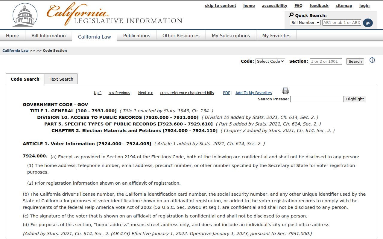
A separate county voter-data application requires a lawful election, political, scholarly, journalistic, or governmental purpose, wet signature, identification, supporting documents, payment, security measures, and use acknowledgments. Elections Code section 2194 restricts permitted uses, and Government Code section 7924.000 protects home addresses, contact details, and identifiers from general disclosure.
The Orange County voter-data request page explains the regulated application route.
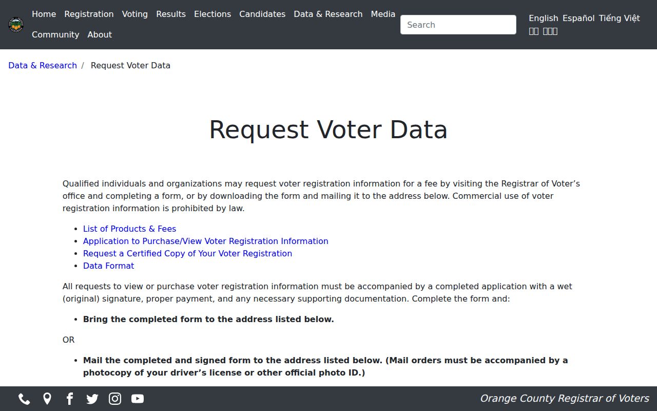
The application route is separate from the statute text, so save the request rules and the legal permission together.
The California Elections Code section 2194 is the statutory source for permitted voter-information uses.
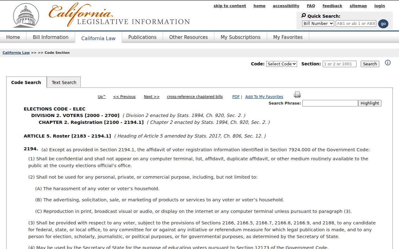
The privacy provision explains why a lawful block lookup may show fewer fields than the underlying election file.
The California Government Code privacy provision explains additional limits on voter identifiers and home information.
Permit Activity Around Laguna Hills Neighbors
Building, engineering, and planning files can show that work took place at an adjacent address and identify an applicant, contractor, owner authorization, inspection, or project scope. Laguna Hills’ current permit service is online, while records issued before January 3, 2023 are labeled legacy. Use the current portal, then the legacy path or a staff request for older work.
A permit is a project record. It does not identify every neighbor, all occupants, or the person who currently uses a structure. An engineering file may connect a street, nearest cross street, house number, APN, tract, lot, property lines, and dimensions. That bridge is useful when GIS labels are unclear.
For a planning notice, preserve the project case number and notice date. For a permit, preserve the permit number and inspection date. A date and case key keeps nearby records from being blended.
Laguna Hills Neighbors and HOA Contacts
Laguna Hills has planned-community neighborhoods and HOA governance, but the research located no official citywide neighborhood-association inventory or public member directory. A published board or management contact may be cited when an organization provides one. A private member roster should not be represented as a public source of Laguna Hills neighbors.
Use the city’s planning, permit, and public-record channels for an accountable project question. A civic group, congregation, block-watch program, school archive, or business directory may have a community connection, but the record’s own access rule controls. Absence from an organization list says nothing about a person’s residence.
The most useful organization record is often a contact route, meeting notice, or dated project file. It is not a household census. Keep that distinction visible when describing a community layer.
Owners Are Not All Laguna Hills Neighbors
An assessor owner or mailing address is the central block clue, but it is not a complete Laguna Hills neighbors list. Nonowners, household members, children, protected residents, utility customers, and people whose records are not indexed may be absent. A trust or entity may also make the underlying people less visible. The right conclusion is “this parcel is connected to this record,” not “everyone here has been found.”
The same limit applies to the recorder, court, and directory sources. A deed names parties to a transaction. A court file names parties and events. A historical city directory selects named adults in a publication year. A permit names project participants. Each source needs its own verb.
Source language. Say owner, assessee, filing party, project participant, authenticated voter, or historical entry when that is what the record actually shows.
Laguna Hills Neighbor Lookup: Privacy Limits
California Safe at Home provides a substitute mailing address and confidential forwarding for qualifying survivors and certain reproductive-health participants. Voter home addresses and identifiers have statutory limits. DMV personal information is restricted by federal law. Vital, juvenile, adoption, sealed, and confidential records have their own access rules. A protected person staying off a map is a lawful result.
Use the California Safe at Home program for program information, never as a way to uncover a protected residence. When a public record is wrong, contact its custodian. When a city record is missing online, make a focused CPRA request for an existing file.
Lawful personal use. Laguna Hills neighbors research can support getting to know a block, reconnecting, family history, and personal safety awareness. Do not use an address trail to stalk, harass, threaten, intimidate, or harm anyone.
A responsible neighbor lookup ends with a source date, a parcel or case identifier, and a clear statement of what remains private or unproved.